Dashboard · Argentina programme · Replica plans · 3D model · How measured
Great House Farm, rebuilt from the records
- Version 0.1
- Register rows 46
- Measured 10
- Scaled 18
- Inferred 15
- Open gaps 3
Great House II, planned near Puerto Madryn in Patagonia, is to be a faithful replica of Great House Farm (Tŷ Mawr): the former manorial house that stood beside St Dochdwy's Church in Llandough until December 1988. Nothing has been built in Argentina yet. This page is where the replica takes shape: the house rebuilt in plans and in 3D from the surviving survey records, with every number traced to its source and given an honest tolerance.
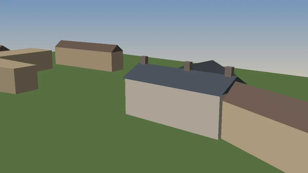
Two places, one house
The vision
In Wales: the guided tour in Llandough walks the public lanes and the churchyard around the place where Great House Farm stood, and these plans let visitors see the house where it was.
In Patagonia: the planned replica would rebuild the same house, room for room, at the scale recorded here: the hall with its end fireplace, the cross passage, the kitchen with its great fireplace and chamfered beams, and the north wing over its barrel-vaulted cellar. Visitors would then be able to follow the story from the Vale of Glamorgan to the Welsh settlements of Chubut.
Read more on the Patagonia half of the estate and the Argentina programme.
Plans and drawings
Scaled, dimensioned
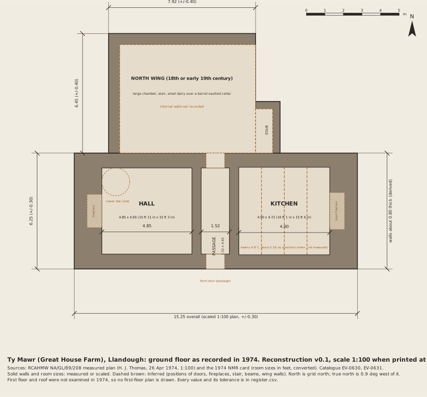
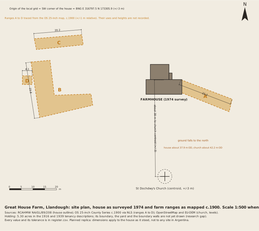
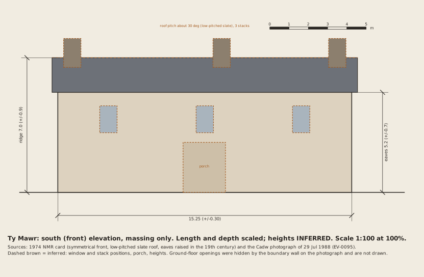
Downloads for architects
Open formats, metres
- CAD drawing (DXF, R12, metres, layered: measured, scaled, inferred, OS ranges)
- 3D massing model (glTF .glb, metres)
- Measurement register (CSV) and JSON: every value with its source, method, tolerance and confidence
- Ground floor (SVG) · Site plan (SVG) · South elevation (SVG)
The local grid starts at the south-west corner of the house, at British National Grid E 316797.5 N 173305.9 (within about 3 m). How this was measured.
What the records do not yet show
Open research
- East 19th-century extension: Card records "further extensions" on the east side; no size. See Range A
- First floor and roof trusses: "it was not possible to examine the first floor and roof trusses"
- Yard and boundary walls: Open yard between the house and the ranges on the 25-inch sheet; walls not traced in this pass
- Heights of every building: no measured section or elevation survives in the records held; the heights here are inferred.
- The farm ranges: only their outlines on the map of about 1900 are held; their uses, heights and openings are not recorded.
Each gap is open as a research task and listed in the missing records register as MR-0060. Better records will replace the inferred values here.
Version 0.1, 31 October 2026. A starting point for design work, not a survey: check the register before relying on any figure.